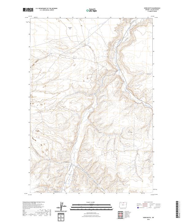
2023 Map of Horn Butte
USGS Topo · Published 2023About this map
Horn Butte stands as a prominent topographical feature in this section of Gilliam County, presiding over a landscape defined by dramatic drainage systems. The northern reaches are characterized by the relatively level expanse of Hurlburt Flats, while the southern and eastern portions are deeply incised by Eightmile Canyon and Fourmile Canyon. These canyons, alongside the winding course of Willow Creek, illustrate the complex erosional patterns typical of the region.
Find a feature on this map
14 named features on this map. Tap any name to fly to it.
Don’t see what you’re looking for? This feature index may not catch every label — zoom into the map to look around manually.
Map Details
Editions of this 2023 Horn Butte Map
This is the sole edition of this map. No revisions or reprints were ever made.
Other maps of this area

1906 · Blalock Island
USGS Topo · 1:125,000

1908 · Blalock Island
USGS Topo · 1:125,000

1916 · Arlington
USGS Topo · 1:125,000

1953 · Pendleton
USGS Topo · 1:250,000

1953 · The Dalles
USGS Topo · 1:250,000

1956 · The Dalles
USGS Topo · 1:250,000

1956 · Pendleton
USGS Topo · 1:250,000

1957 · The Dalles
USGS Topo · 1:250,000

1962 · Alderdale
USGS Topo · 1:24,000

1962 · Heppner Junction
USGS Topo · 1:24,000