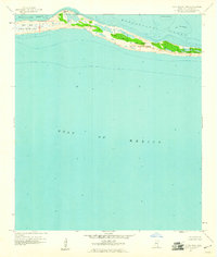
1960 Map of Horn Island West
USGS Topo · Published 1961About this map
Horn Island stretches across this 1960 coastal study, serving as a critical barrier between the Mississippi Sound and the open Gulf of Mexico. The island's geography is defined by the Horn Island National Wildlife Refuge, which preserves the narrow, sandy landform and its internal marshy depressions. Noteworthy aquatic features include the shallow Middle Ground to the north and the curved inlet of The Horseshoe near the eastern edge of this quadrangle.
Find a feature on this map
8 named features on this map. Tap any name to fly to it.
Don’t see what you’re looking for? This feature index may not catch every label — zoom into the map to look around manually.
Map Details
Editions of this 1960 Horn Island West Map
This is the sole edition of this map. No revisions or reprints were ever made.
Other maps of this area

1941 · Horn Island
USGS Topo · 1:62,500

1942 · Horn Island
USGS Topo · 1:62,500

1943 · Pascagoula
USGS Topo · 1:62,500

1950 · Dog Keys Pass
USGS Topo · 1:24,000

1953 · Mobile
USGS Topo · 1:250,000

1954 · Deer Island
USGS Topo · 1:24,000

1954 · Biloxi
USGS Topo · 1:62,500

1955 · Pascagoula
USGS Topo · 1:62,500

1957 · Mobile
USGS Topo · 1:250,000

1960 · Mobile
USGS Topo · 1:250,000