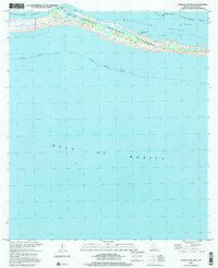
2000 Map of Horn Island West
USGS Topo · Published 2001About this map
Horn Island stands as a slender barrier between the open Gulf of Mexico and the calmer waters of the Mississippi Sound. This section of the Gulf Islands National Seashore is characterized by its dynamic coastal environment, where low-lying marshes and sandy ridges shift against the tide. The map reveals remnants of human utility on this isolated landscape, specifically the Flowing Well, Chimney Well, and a Gaging Station Pier along the northern shore. These features suggest the island's role in coastal monitoring and its limited, specialized infrastructure. Landmarks like The Horseshoe and the shallow Middle Ground indicate the complex bathymetry that has long challenged and guided mariners navigating these barrier island passes.
Find a feature on this map
13 named features on this map. Tap any name to fly to it.
Don’t see what you’re looking for? This feature index may not catch every label — zoom into the map to look around manually.
Map Details
Editions of this 2000 Horn Island West Map
This is the sole edition of this map. No revisions or reprints were ever made.
Other maps of this area

1941 · Horn Island
USGS Topo · 1:62,500

1942 · Horn Island
USGS Topo · 1:62,500

1943 · Pascagoula
USGS Topo · 1:62,500

1950 · Dog Keys Pass
USGS Topo · 1:24,000

1953 · Mobile
USGS Topo · 1:250,000

1954 · Deer Island
USGS Topo · 1:24,000

1954 · Biloxi
USGS Topo · 1:62,500

1955 · Pascagoula
USGS Topo · 1:62,500

1957 · Mobile
USGS Topo · 1:250,000

1960 · Mobile
USGS Topo · 1:250,000