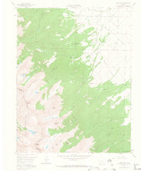
1959 Map of Horn Peak
USGS Topo · Published 1966About this map
The Sangre de Cristo Mountains dominate this 1959 survey, where the peaks of Horn Peak and Comanche Peak tower over the high-altitude terrain. The landscape is divided by the Custer Co Saguache Co line, which follows the ridgeline between the San Isabel National Forest and Rio Grande National Forest. Lower elevations to the east descend into the Wet Mountain Valley, where early-twentieth-century recreational and residential sites like Horn Creek Ranch, Abbots Lodge, and Tanglewood Acres are established near the Forest Boundary.
Find a feature on this map
51 named features on this map. Tap any name to fly to it.
Don’t see what you’re looking for? This feature index may not catch every label — zoom into the map to look around manually.
Map Details
Editions of this 1959 Horn Peak Map
4 editions found
Other maps of this area

1889 · Canon City
USGS Topo · 1:125,000

1889 · Huerfano Park
USGS Topo · 1:125,000

1892 · Huerfano Park
USGS Topo · 1:125,000

1892 · Canon City
USGS Topo · 1:125,000

1954 · Trinidad
USGS Topo · 1:250,000

1954 · Pueblo
USGS Topo · 1:250,000

1955 · Westcliffe
USGS Topo · 1:24,000

1955 · Trinidad
USGS Topo · 1:250,000

1957 · Pueblo
USGS Topo · 1:250,000

1957 · Aldrich Gulch
USGS Topo · 1:24,000