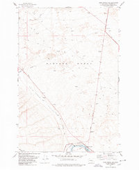
1977 Map of Horn Rapids Dam
USGS Topo · Published 1978About this map
Hanford Works dominates the northern reaches of this landscape, its restricted area marked by numerous test wells and security checkpoints like the Wye Barricade. This 1970s survey captures a starkly industrial and military-managed environment where the arid expanse of the Cold Creek Valley meets the technological infrastructure of the nuclear age. To the south, the Yakima River provides a sharp contrast, winding past Horn Rapids Park and the Horn Rapids Dam.
Find a feature on this map
19 named features on this map. Tap any name to fly to it.
Don’t see what you’re looking for? This feature index may not catch every label — zoom into the map to look around manually.
Map Details
Editions of this 1977 Horn Rapids Dam Map
This is the sole edition of this map. No revisions or reprints were ever made.
Other maps of this area

1915 · Prosser
USGS Topo · 1:125,000

1916 · Coyote Rapids
USGS Topo · 1:62,500

1917 · Pasco
USGS Topo · 1:125,000

1917 · Prosser
USGS Topo · 1:125,000

1924 · Hanford
USGS Topo · 1:62,500

1951 · Richland
USGS Topo · 1:62,500

1951 · Hanford
USGS Topo · 1:62,500

1951 · Corral Canyon
USGS Topo · 1:62,500

1951 · Coyote Rapids
USGS Topo · 1:62,500

1953 · Walla Walla
USGS Topo · 1:250,000