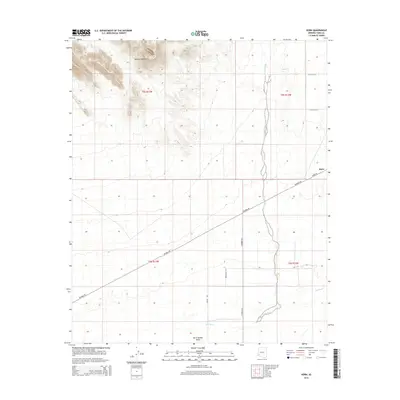
2014 Map of Horn
USGS Topo · Published 2014About this map
Palomas Mountains rise sharply in the northwest corner of this Yuma County landscape, casting long shadows over the transition into the San Cristobal Valley. This desert environment is defined by its drainage patterns, with the winding course of the Gila River cutting across the southern portion of the map while Hoodoo Wash descends from the higher elevations to the north. The small settlement of Horn serves as a lone outpost along the intersection of Hyder Rd and Palomas Rd, marking a vital junction for travel through the arid plains. The grid of township lines and local routes like Avenue 63E reveals a sparse but organized human presence in a territory where water sources and mountain passes dictate the layout of roads and habitation.
Find a feature on this map
16 named features on this map. Tap any name to fly to it.
Don’t see what you’re looking for? This feature index may not catch every label — zoom into the map to look around manually.
Map Details
Editions of this 2014 Horn Map
This is the sole edition of this map. No revisions or reprints were ever made.
Other maps of this area

1927 · Hyder
USGS Topo · 1:62,500

1929 · Aztec
USGS Topo · 1:62,500

1930 · Stoval
USGS Topo · 1:62,500

1930 · Hyder
USGS Topo · 1:62,500

1942 · Vicksburg
USGS Topo · 1:250,000

1950 · Stoval
USGS Topo · 1:62,500

1950 · Aztec
USGS Topo · 1:62,500

1953 · Ajo
USGS Topo · 1:250,000

1954 · Phoenix
USGS Topo · 1:250,000

1957 · Ajo
USGS Topo · 1:250,000