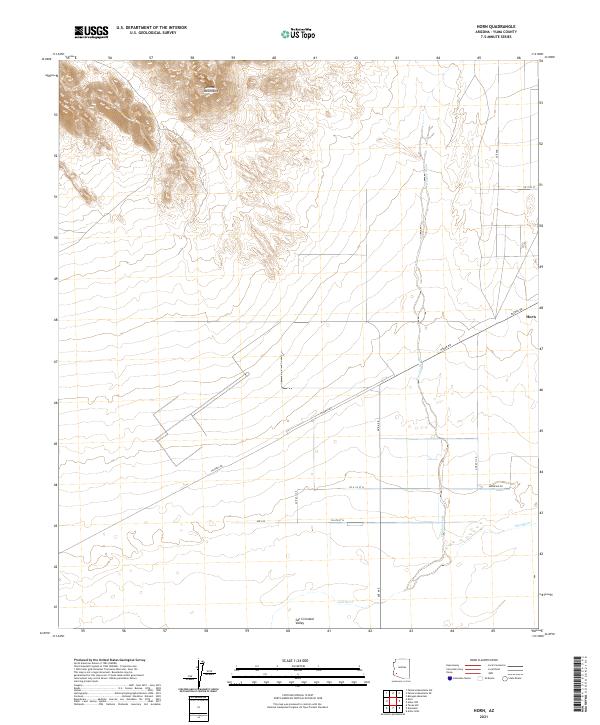
2021 Map of Horn
USGS Topo · Published 2021About this map
The Palomas Mountains rise above the arid basin floor, overlooking the intersection of desert washes and sparse agricultural corridors in this part of Yuma County. The small settlement of Horn sits along the northern edge of a straight-line transport corridor defined by Hyder Rd and the Southern Pacific rail alignment, providing a focused point of human presence within the wide San Cristobal Valley. To the south, the Gila River meanders across the landscape, flanked by the seasonal drainage of Hoodoo Wash. The map reveals a strict grid of county roads, including Palmas Rd and Ave 64 E, which delineate land parcels and access points throughout the valley. This 2021 survey illustrates the modern configuration of desert roads and water management systems near the river bottomlands.
Find a feature on this map
21 named features on this map. Tap any name to fly to it.
Don’t see what you’re looking for? This feature index may not catch every label — zoom into the map to look around manually.
Map Details
Editions of this 2021 Horn Map
This is the sole edition of this map. No revisions or reprints were ever made.
Other maps of this area

1927 · Hyder
USGS Topo · 1:62,500

1929 · Aztec
USGS Topo · 1:62,500

1930 · Stoval
USGS Topo · 1:62,500

1930 · Hyder
USGS Topo · 1:62,500

1942 · Vicksburg
USGS Topo · 1:250,000

1950 · Stoval
USGS Topo · 1:62,500

1950 · Aztec
USGS Topo · 1:62,500

1953 · Ajo
USGS Topo · 1:250,000

1954 · Phoenix
USGS Topo · 1:250,000

1957 · Ajo
USGS Topo · 1:250,000