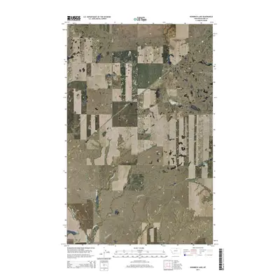
2014 Map of Hornbeck Lake
USGS Topo · Published 2014About this map
Hornbeck Lake and Duck Lake anchor this High Plains landscape in northern Montana, where the terrain is defined by the subtle drainage patterns of Savoy Cr. The map illustrates a strictly rural environment dominated by the Public Land Survey System, with the land meticulously divided into sections across townships T33N, T34N, and T35N. Transportation in this part of Blaine County relies on a network of named section-line roads and trails, such as Violet Rd, Maloney Trail Rd, and Wayne Creek Rd, which provide access to the remote coulees and prairie. The prominent diagonal of MT-241 cuts across the gridded landscape, serving as the primary corridor through the area. Notable geological depressions like Lone Tree Coulee and the headwaters of E Savoy Cr and W Savoy Cr reveal the natural water-flow paths that historically dictated ranching and settlement boundaries in this northern frontier region.
Find a feature on this map
19 named features on this map. Tap any name to fly to it.
Don’t see what you’re looking for? This feature index may not catch every label — zoom into the map to look around manually.
Map Details
Editions of this 2014 Hornbeck Lake Map
This is the sole edition of this map. No revisions or reprints were ever made.
Other maps of this area

1903 · Wayne Creek
USGS Topo · 1:62,500

1905 · Wayne Creek
USGS Topo · 1:62,500

1913 · Cherry Ridge
USGS Topo · 1:125,000

1920 · Avery
USGS Topo · 1:125,000

1953 · Havre
USGS Topo · 1:250,000

1957 · Havre
USGS Topo · 1:250,000

1958 · Havre
USGS Topo · 1:250,000

1964 · Wayne Creek SE
USGS Topo · 1:24,000
1964 · Grable Coulee
USGS Topo · 1:24,000

1984 · Hogeland SE
USGS Topo · 1:24,000