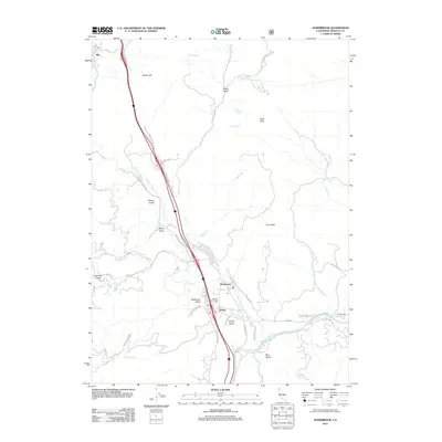
2012 Map of Hornbrook
USGS Topo · Published 2012About this map
The Klamath River winds through the southern reaches of this Siskiyou County landscape, passing the small communities of Hornbrook and Henley. This corridor has long served as a vital transit route through the mountains, evidenced by the modern highway alignment paralleling Cottonwood Cr and passing beneath the shadows of Horn Peak and Little Pilot. Near the river, the settlement of Klamathon and the Henley-Hornbrook Cem provide specific points of interest for those tracing local family lineages. To the north, the map includes the community of Hilt and a portion of the Rogue River National Forest along the Oregon border. Numerous named drainages like Rancheria Gulch and Blue Gulch cut through the terrain, illustrating the complex geography that shaped early ranching and mining access via roads such as Bailey Hill Rd and Rancheria Creek Rd.
Find a feature on this map
43 named features on this map. Tap any name to fly to it.
Don’t see what you’re looking for? This feature index may not catch every label — zoom into the map to look around manually.
Map Details
Editions of this 2012 Hornbrook Map
This is the sole edition of this map. No revisions or reprints were ever made.
Other maps of this area

1886 · Shasta
USGS Topo · 1:250,000

1891 · Ashland
USGS Topo · 1:250,000

1893 · Ashland
USGS Topo · 1:250,000

1894 · Shasta
USGS Topo · 1:250,000

1897 · Ashland
USGS Topo · 1:250,000

1922 · Shasta Valley Sheet No 15
USGS Topo · 1:24,000

1922 · Shasta Valley Sheet No 14
USGS Topo · 1:24,000

1932 · Yreka
USGS Topo · 1:96,000

1934 · Macdoel
USGS Topo · 1:96,000

1938 · Medford
USGS Topo · 1:125,000