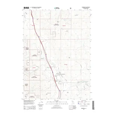
2015 Map of Hornbrook
USGS Topo · Published 2015About this map
Hornbrook and the nearby settlement of Henley anchor this portion of the Siskiyou Mountains, where the Klamath River winds through a landscape of steep gulches and high peaks. The terrain is defined by dramatic elevation changes, notably at Horn Peak and Little Pilot, while significant portions of the west and north are protected as part of the Klamath National Forest. This mapping reflects a modern intersection of infrastructure and topography, where major transit corridors follow the natural path carved by Cottonwood Cr toward the Oregon border. Genealogists and local historians can pinpoint the Henley-Hornbrook Cemetery and trace the network of rural roads such as Ditch Creek Rd and Copco Rd that connect isolated homesteads and forest boundaries. The inclusion of the settlement of Hilt near the northern edge highlights the area's long-standing connection to the timber and rail industries that have historically shaped this border region.
Find a feature on this map
64 named features on this map. Tap any name to fly to it.
Don’t see what you’re looking for? This feature index may not catch every label — zoom into the map to look around manually.
Map Details
Editions of this 2015 Hornbrook Map
This is the sole edition of this map. No revisions or reprints were ever made.
Other maps of this area

1886 · Shasta
USGS Topo · 1:250,000

1891 · Ashland
USGS Topo · 1:250,000

1893 · Ashland
USGS Topo · 1:250,000

1894 · Shasta
USGS Topo · 1:250,000

1897 · Ashland
USGS Topo · 1:250,000

1922 · Shasta Valley Sheet No 15
USGS Topo · 1:24,000

1922 · Shasta Valley Sheet No 14
USGS Topo · 1:24,000

1932 · Yreka
USGS Topo · 1:96,000

1934 · Macdoel
USGS Topo · 1:96,000

1938 · Medford
USGS Topo · 1:125,000