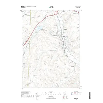
2019 Map of Hornell
USGS Topo · Published 2019About this map
The Canisteo River and Canacadea Creek converge near the city of Hornell, a primary industrial and transit hub of Steuben County. This 2019 survey documents the modern layout of the valley, where Almond Lake and the Canisteo Reservoir manage the local hydrology. The map is particularly dense with genealogical data, showing a high concentration of burial grounds including Hope Cem, Saint Ann's Cem, and Temple Beth El Cem. These sites, along with the Rural Cem, cluster around the northern neighborhoods and the settlement of North Hornell. Significant engineering features like the Ganacadea Creek Bridge and Seneca Road Bridge provide vital crossings for the region's roadway network. Surrounding the valley, prominent elevations such as Pennsylvania Hill, Bald Hill, and Ashbaugh Hill define the steep-walled character of this portion of the Southern Tier.
Find a feature on this map
143 named features on this map. Tap any name to fly to it.
Don’t see what you’re looking for? This feature index may not catch every label — zoom into the map to look around manually.
Map Details
Editions of this 2019 Hornell Map
This is the sole edition of this map. No revisions or reprints were ever made.
Other maps of this area

1915 · Hornell
USGS Topo · 1:62,500

1916 · Canaseraga
USGS Topo · 1:62,500

1918 · Hornell
USGS Topo · 1:62,500

1926 · Wellsville
USGS Topo · 1:62,500

1926 · Greenwood
USGS Topo · 1:62,500

1940 · Canaseraga
USGS Topo · 1:62,500

1950 · Elmira
USGS Topo · 1:250,000

1954 · South Canisteo
USGS Topo · 1:24,000
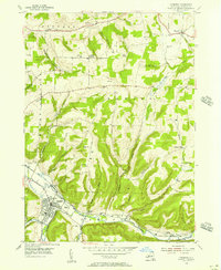
1954 · Canisteo
USGS Topo · 1:24,000

1958 · Elmira
USGS Topo · 1:250,000