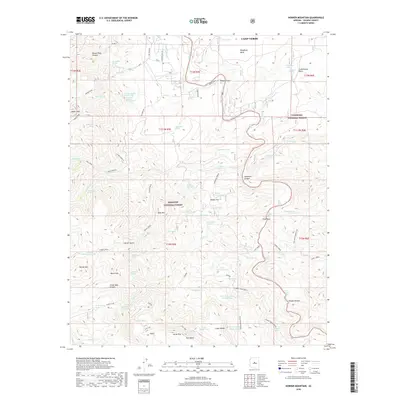
2018 Map of Horner Mountain
USGS Topo · Published 2018About this map
Beasley Flat serves as a prominent landmark along the Verde River as it winds through this portion of Yavapai County. The landscape is defined by its complex hydrology and dramatic relief, transitioning from the high point of Squaw Peak in the northwest to the expansive Tule Mesa and Verde Rim in the south. Named water sources like Amerone Spring Number One, North Mine Spring, and Goat Springs are scattered throughout the Prescott National Forest and Coconino National Forest, indicating the vital role of these isolated springs in an arid environment. Evidence of local history and rugged geography is found in places like Gospel Hollow, Punk Rock, and the foreboding Hell Hole. Movement through the area is facilitated by primitive routes such as S Salt Mine Rd and Towel Creek, connecting various livestock and water management features like Rodeo Flat Tank and Oxbow Tank.
Find a feature on this map
95 named features on this map. Tap any name to fly to it.
Don’t see what you’re looking for? This feature index may not catch every label — zoom into the map to look around manually.
Map Details
Editions of this 2018 Horner Mountain Map
This is the sole edition of this map. No revisions or reprints were ever made.
Other maps of this area

1887 · Verde
USGS Topo · 1:250,000

1892 · Verde
USGS Topo · 1:250,000

1923 · Camp Verde
USGS Topo · 1:125,000

1929 · Turret Peak
USGS Topo · 1:125,000

1932 · Camp Verde
USGS Topo · 1:125,000

1933 · Turret Peak
USGS Topo · 1:125,000

1936 · Camp Verde
USGS Topo · 1:125,000

1954 · Holbrook
USGS Topo · 1:250,000

1957 · Holbrook
USGS Topo · 1:250,000

1958 · Holbrook
USGS Topo · 1:250,000