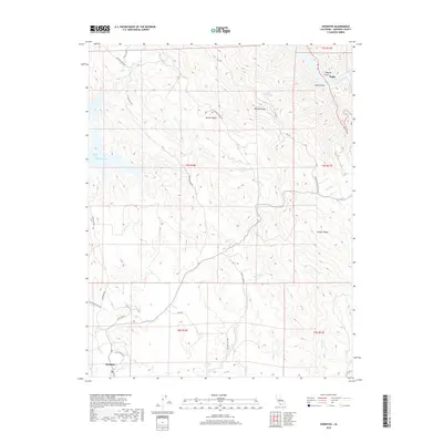
2018 Map of Hornitos
USGS Topo · Published 2018About this map
Hornitos anchors the southwestern corner of this Mariposa County landscape, where the foothills transition toward the high ground of Williams Peak and Juniper Ridge. The terrain is deeply incised by a network of seasonal watercourses, including Eldorado Cr, Cotton Cr, and Burns Cr, which flow through the steep topography of the western Sierra Nevada. To the north, the settlement of Hunter Valley occupies a prominent basin between the ridges, while the far northeastern corner reveals the Merced River canyon at Bagby. This 2018 survey documents the intricate modern road network connecting these historic ranching and mining locales, with Hunters Valley Rd and Mount Gaines Rd providing access through the backcountry. Near the western edge, the influence of modern infrastructure is evident where the Cotton Arm Lake McClure reaches into the hills near Exchequer Dam Rd.
Find a feature on this map
34 named features on this map. Tap any name to fly to it.
Don’t see what you’re looking for? This feature index may not catch every label — zoom into the map to look around manually.
Map Details
Editions of this 2018 Hornitos Map
This is the sole edition of this map. No revisions or reprints were ever made.
Other maps of this area

1893 · Sonora
USGS Topo · 1:125,000

1896 · Sonora
USGS Topo · 1:125,000

1897 · Sonora
USGS Topo · 1:125,000

1898 · Sonora
USGS Topo · 1:125,000

1916 · Merced Falls
USGS Topo · 1:24,000

1919 · Indian Gulch
USGS Topo · 1:48,000

1919 · Haystack Mountain
USGS Topo · 1:31,680

1919 · Merced Falls
USGS Topo · 1:31,680

1920 · Indian Gulch
USGS Topo · 1:62,500

1944 · Merced Falls
USGS Topo · 1:62,500