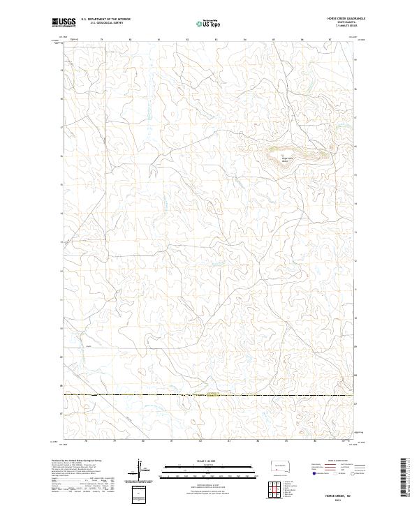
2021 Map of Horse Creek
USGS Topo · Published 2021About this map
Eagle Nest Butte dominates the central landscape of this western South Dakota region, standing as a prominent landmark above a complex network of prairie drainages. The topography is defined by the winding paths of Eagle Nest Cr and Bear-in-the-Lodge Cr, which carve through the open terrain of Jackson and Bennett counties. This contemporary survey illustrates a sparsely populated ranching landscape where transport is limited to local routes like Hisle Rd and BIA Rd, reflecting the long-standing land divisions of the Public Land Survey System. The map documents the headwaters of Horse Cr and Settin Up Cr, providing a detailed look at the seasonal watercourses that have shaped the ecology and settlement patterns of this high plains area.
Find a feature on this map
16 named features on this map. Tap any name to fly to it.
Don’t see what you’re looking for? This feature index may not catch every label — zoom into the map to look around manually.
Map Details
Editions of this 2021 Horse Creek Map
This is the sole edition of this map. No revisions or reprints were ever made.
Other maps of this area

1950 · Interior SE
USGS Topo · 1:24,000

1950 · Wanblee
USGS Topo · 1:24,000

1955 · Martin
USGS Topo · 1:250,000

1958 · Martin
USGS Topo · 1:250,000

1980 · Kadoka
USGS Topo · 1:100,000

1981 · Patricia
USGS Topo · 1:25,000

1981 · Broken Leg Dam
USGS Topo · 1:24,000

1981 · Allen
USGS Topo · 1:25,000

1981 · Hisle
USGS Topo · 1:25,000
1981 · Buzzard Butte
USGS Topo · 1:25,000