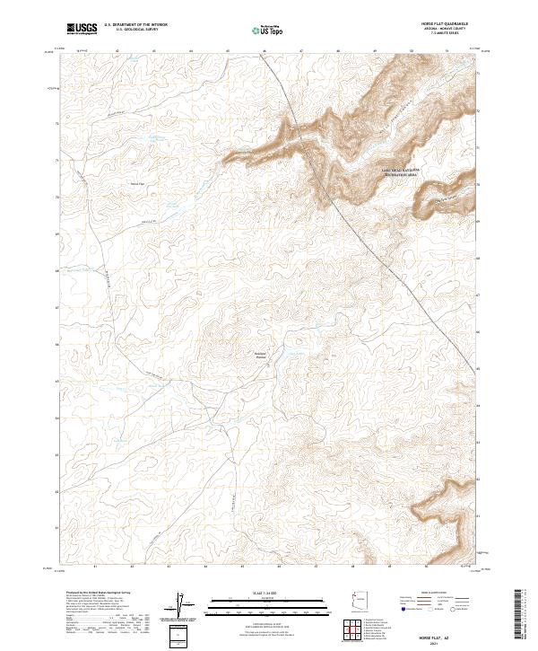
2021 Map of Horse Flat
USGS Topo · Published 2021About this map
The Hualapai Plateau defines this landscape of high desert drainage systems and remote stock tanks. This map documents a transition between the elevated plateau and the deep erosion of Horse Flat Canyon, where ephemeral water sources like Reference Point Cr and Lost Cr carve through the arid terrain. The eastern edge of the map enters the Lake Mead National Recreation Area, reflecting the region's conservation and recreational status.
Find a feature on this map
25 named features on this map. Tap any name to fly to it.
Don’t see what you’re looking for? This feature index may not catch every label — zoom into the map to look around manually.
Map Details
Editions of this 2021 Horse Flat Map
This is the sole edition of this map. No revisions or reprints were ever made.
Other maps of this area

1886 · Diamond Creek
USGS Topo · 1:250,000

1892 · Diamond Creek
USGS Topo · 1:250,000

1948 · Williams
USGS Topo · 1:250,000

1954 · Williams
USGS Topo · 1:250,000

1956 · Williams
USGS Topo · 1:250,000

1960 · Williams
USGS Topo · 1:250,000

1961 · Williams
USGS Topo · 1:250,000
1967 · Milkweed Canyon NW
USGS Topo · 1:24,000
1967 · Devils Slide Rapids
USGS Topo · 1:24,000
1967 · Spencer Canyon
USGS Topo · 1:24,000