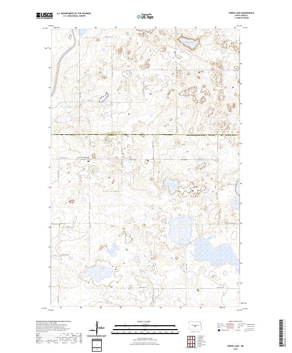
2024 Map of Horse Lake
USGS Topo · Published 2024About this map
Johns Lake Mennonite Brethem Cem sits at the center of this rural prairie landscape on the border of Sheridan and Burleigh Counties. The terrain is defined by a dense network of prairie potholes and wetlands, protected in part by the Sheridan County Waterfowl Production Area and the Burleigh County Waterfowl Production Area. These natural features dominate the eastern half of the map, while the western edge is marked by the engineering of the McClusky Canal, which cuts through the township sections. Large water bodies like Horse Lake and Pelican Lake provide focal points for the region's hydrology. The map reflects a classic North Dakota section-line road grid, including routes like 184th St NE and 471st Ave NE, which connect the isolated farmsteads and agricultural tracts that characterize this high plains environment.
Find a feature on this map
30 named features on this map. Tap any name to fly to it.
Don’t see what you’re looking for? This feature index may not catch every label — zoom into the map to look around manually.
Map Details
Editions of this 2024 Horse Lake Map
This is the sole edition of this map. No revisions or reprints were ever made.
Other maps of this area

1954 · McClusky
USGS Topo · 1:250,000

1958 · McClusky
USGS Topo · 1:250,000

1959 · Pickardville
USGS Topo · 1:24,000

1959 · Mercer SE
USGS Topo · 1:24,000

1959 · McClusky
USGS Topo · 1:24,000

1960 · Horse Lake
USGS Topo · 1:24,000

1960 · Florence Lake
USGS Topo · 1:24,000

1960 · Denhoff
USGS Topo · 1:24,000
1979 · Regan
USGS Topo · 1:24,000

1979 · Canfield Lake
USGS Topo · 1:24,000