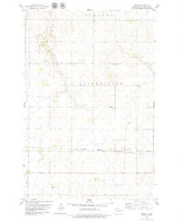
1979 Map of Regan
USGS Topo · Published 1979About this map
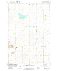
Regan serves as the primary hub of this North Dakota prairie landscape, situated along the tracks of the Burlington Northern railroad. The layout of the region is defined by a rigorous grid of section lines and township boundaries, including Steiber, Estherville, Ghylin, and Ecklund. These administrative divisions underscore the late 20th-century agricultural organization of Burleigh County, where fine red dashed lines on the map indicate field boundaries and fences identified from aerial photography. To the northwest, the significant depression of Grass Lake breaks the terrain, while scattered Gravel Pits suggest the importance of local materials for road building and maintenance. A prominent Radio Tower in the southwest and occasional Wells dot the landscape, reflecting the essential infrastructure required to support this remote farming community.
Find a feature on this map
12 named features on this map. Tap any name to fly to it.
Don’t see what you’re looking for? This feature index may not catch every label — zoom into the map to look around manually.
Map Details
Editions of this 1979 Regan Map
This is the sole edition of this map. No revisions or reprints were ever made.
Other maps of this area

1954 · McClusky
USGS Topo · 1:250,000

1958 · McClusky
USGS Topo · 1:250,000

1959 · Mercer SW
USGS Topo · 1:24,000

1959 · Mercer SE
USGS Topo · 1:24,000

1960 · Horse Lake
USGS Topo · 1:24,000
1975 · Wing SW
USGS Topo · 1:24,000
1975 · Regan SE
USGS Topo · 1:24,000
1979 · Baldwin
USGS Topo · 1:24,000

1979 · Canfield Lake
USGS Topo · 1:24,000
1979 · Grass Lake
USGS Topo · 1:24,000