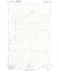
1979 Map of Baldwin
USGS Topo · Published 1979About this map
Baldwin serves as a small but vital hub for the surrounding plains, established along the Soo Line railroad during the late 1970s. The landscape is primarily defined by the townships of Eck Lund and Crofte, showing a clear grid of section lines and rural access roads. The Baldwin Cem and a nearby Gravel Pit reflect the local economy and community history of this North Dakota prairie.
Find a feature on this map
12 named features on this map. Tap any name to fly to it.
Don’t see what you’re looking for? This feature index may not catch every label — zoom into the map to look around manually.
Map Details
Editions of this 1979 Baldwin Map
This is the sole edition of this map. No revisions or reprints were ever made.
Other maps of this area

1907 · Bismarck
USGS Topo · 1:125,000

1950 · Wilton
USGS Topo · 1:62,500

1951 · Bismarck
USGS Topo · 1:62,500

1951 · Menoken
USGS Topo · 1:62,500

1954 · Bismarck
USGS Topo · 1:250,000

1954 · McClusky
USGS Topo · 1:250,000

1958 · Bismarck
USGS Topo · 1:250,000

1958 · McClusky
USGS Topo · 1:250,000
1962 · Burnt Butte
USGS Topo · 1:24,000

1966 · Wilton SE
USGS Topo · 1:24,000