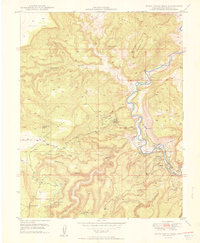
1950 Map of Horse Range Mesa
USGS Topo · Published 1950About this map
The United States Atomic Energy Commission and the USGS collaborated on this 1950 survey, which highlights the intense mineral exploration in San Miguel County during the early Cold War. The landscape is defined by the winding Dolores River, which carves through a series of dramatic plateaus including Island Mesa and the expansive Horse Range Mesa. The map serves as a primary record of the region's uranium and vanadium mining history, specifically documenting the McIntyre Mines, Veta Mad Mine, and a cluster of numbered claims like Radium No 5 Mine and Radium No 2 Mine. These workings are concentrated along the canyon walls and rimrock above Poverty Flat. In the settlement of Slick Rock, a Water Tower stands near the river, marking a small but vital hub for the prospectors and miners working the surrounding rugged drainages of Cougar Canyon and Summit Canyon.
Find a feature on this map
33 named features on this map. Tap any name to fly to it.
Don’t see what you’re looking for? This feature index may not catch every label — zoom into the map to look around manually.
Map Details
Editions of this 1950 Horse Range Mesa Map
2 editions found

Other maps of this area

1885 · La Sal
USGS Topo · 1:250,000

1886 · Abajo
USGS Topo · 1:250,000

1892 · Abajo
USGS Topo · 1:250,000

1893 · Abajo
USGS Topo · 1:250,000

1916 · Paradox Valley
USGS Topo · 1:125,000

1922 · Paradox Valley
USGS Topo · 1:125,000

1948 · Bull Canyon
USGS Topo · 1:24,000

1948 · Horse Range Mesa
USGS Topo · 1:24,000

1948 · Hamm Canyon
USGS Topo · 1:24,000

1949 · Bull Canyon
USGS Topo · 1:24,000