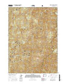
2017 Map of Horse Sign Butte
USGS Topo · Published 2017About this map
Siskiyou National Forest land defines this landscape, where the Illinois River cuts through the border of Curry and Josephine Counties. The map reveals a high-elevation backcountry marked by prominent peaks like Horse Sign Butte and Lawson Butte, while the water system is defined by rapid-filled drainage including Horse Sign Creek Rapids and tributaries like Lawson Cr and Indigo Cr. Evidence of seasonal use and forest management is visible through labels like Game Lake, Indian Flat, and the Nat For Dev Rd 420. Topographical details highlight riverside features such as Collier Bar and Buzzards Roost, offering a clear view of the drainage patterns and land-survey boundaries that shaped this part of the Klamath Mountains in the early twenty-first century.
Find a feature on this map
23 named features on this map. Tap any name to fly to it.
Don’t see what you’re looking for? This feature index may not catch every label — zoom into the map to look around manually.
Map Details
Editions of this 2017 Horse Sign Butte Map
This is the sole edition of this map. No revisions or reprints were ever made.
Other maps of this area

1899 · Port Orford
USGS Topo · 1:125,000

1903 · Port Orford
USGS Topo · 1:125,000

1917 · Kerby
USGS Topo · 1:125,000

1918 · Kerby
USGS Topo · 1:125,000

1945 · Kerby
USGS Topo · 1:125,000

1954 · Coos Bay
USGS Topo · 1:250,000

1954 · Marial
USGS Topo · 1:62,500

1954 · Collier Butte
USGS Topo · 1:62,500

1954 · Agness
USGS Topo · 1:62,500

1954 · Pearsoll Peak
USGS Topo · 1:62,500