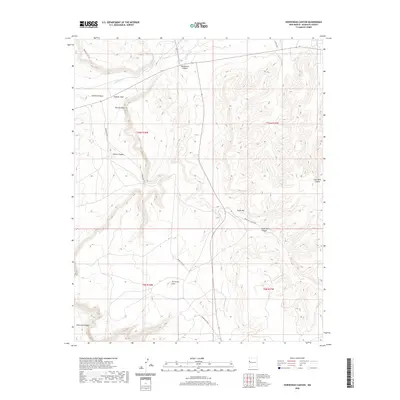
2020 Map of Horsehead Canyon
USGS Topo · Published 2020About this map
Rio Nutria and Rio Pescado converge in this high desert landscape of McKinley County, forming the headwaters of the Zuni River. The terrain is defined by a series of deep drainages and distinctive geological formations, including the prominent Horsehead Canyon and Knife Hill. To the west, landmarks like Feather Rock and Pierced Rock rise above the mesas, while the settlement of Two Grey Hills marks a point of human habitation along the Indian Svc Rte 9 corridor. The map reveals a network of service roads and natural canyons, such as Coal Mine Canyon and Galestina Canyon, which illustrate the complex topography of the Zuni Reservation area. This late-modern survey documents the persistent pathways and named landforms that have long guided movement through this arid interior.
Find a feature on this map
21 named features on this map. Tap any name to fly to it.
Don’t see what you’re looking for? This feature index may not catch every label — zoom into the map to look around manually.
Map Details
Editions of this 2020 Horsehead Canyon Map
This is the sole edition of this map. No revisions or reprints were ever made.
Other maps of this area

1886 · Wingate
USGS Topo · 1:250,000

1892 · Wingate
USGS Topo · 1:250,000

1954 · Saint Johns
USGS Topo · 1:250,000

1954 · Gallup
USGS Topo · 1:250,000

1957 · Saint Johns
USGS Topo · 1:250,000

1958 · Gallup
USGS Topo · 1:250,000

1958 · Saint Johns
USGS Topo · 1:250,000

1959 · Gallup
USGS Topo · 1:250,000

1962 · Gallup
USGS Topo · 1:250,000

1962 · Saint Johns
USGS Topo · 1:250,000