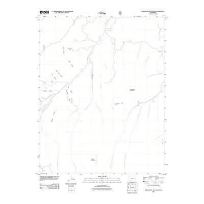
2011 Map of Horseshoe Mountain
USGS Topo · Published 2011About this map
Horseshoe Mountain and Poison Mountain anchor this high-altitude landscape in Rio Grande County, defined by a complex network of seasonal drainages and named canyons. The terrain transitions from the open stretches of Horseshoe Park and Raton Park into steep-walled corridors like Warr Canyon, Pole Canyon, and Barriclause Canyon. This 2011 survey documents the intricate headwaters of the regional watershed, where the West Fork, Middle Fork, and East Fork San Francisco Creek converge. Human presence is marked primarily by forest service routes and historical tracks like Wagon Wheel Rd near Spring Branch. The mapping reveals a rugged interior where landmarks like Dry Lake Flats and Cedar Spring served as vital reference points for ranchers and early travelers navigating the backcountry between Pinos Creek and Bennett Creek.
Find a feature on this map
41 named features on this map. Tap any name to fly to it.
Don’t see what you’re looking for? This feature index may not catch every label — zoom into the map to look around manually.
Map Details
Editions of this 2011 Horseshoe Mountain Map
This is the sole edition of this map. No revisions or reprints were ever made.
Other maps of this area

1913 · Summitville
USGS Topo · 1:125,000

1914 · Creede
USGS Topo · 1:125,000

1915 · Summitville
USGS Topo · 1:125,000

1915 · Del Norte
USGS Topo · 1:125,000

1916 · Creede
USGS Topo · 1:125,000

1917 · Del Norte
USGS Topo · 1:125,000

1922 · Conejos
USGS Topo · 1:125,000

1945 · Durango
USGS Topo · 1:250,000

1953 · Durango
USGS Topo · 1:250,000

1954 · Durango
USGS Topo · 1:250,000