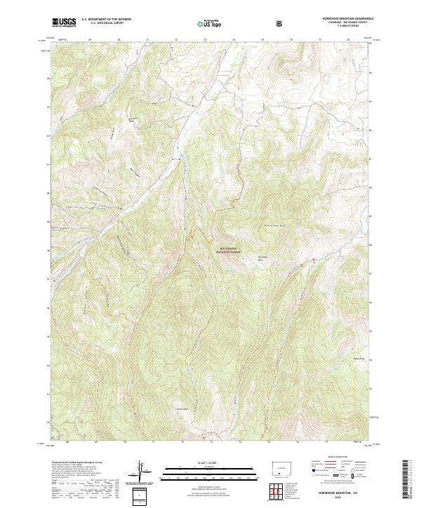
2022 Map of Horseshoe Mountain
USGS Topo · Published 2022About this map
Rio Grande National Forest dominates the high-altitude landscape of this 2022 survey, where complex drainage networks like Pinos Cr and San Francisco Cr carve through the Southern Rockies. The terrain is defined by prominent peaks including Horseshoe Mtn and Poison Mtn, while open areas like Horseshoe Park and Raton Park offer a contrast to the heavily wooded slopes. A dense system of backcountry routes, such as the Middle Frisco Trl and Bennett Trl, illustrates the modern recreation and access patterns within the national forest. The map also captures specialized terrain features like Dry Lake Flats and family-named canyons, including Barriclause Canyon and Munger Canyon, providing a detailed view of this remote portion of Rio Grande County. From the waters of Cedar Spring to the headwaters of the N Fork Raton Cr, the geography remains largely untamed by permanent settlement.
Find a feature on this map
39 named features on this map. Tap any name to fly to it.
Don’t see what you’re looking for? This feature index may not catch every label — zoom into the map to look around manually.
Map Details
Editions of this 2022 Horseshoe Mountain Map
This is the sole edition of this map. No revisions or reprints were ever made.
Other maps of this area

1913 · Summitville
USGS Topo · 1:125,000

1914 · Creede
USGS Topo · 1:125,000

1915 · Summitville
USGS Topo · 1:125,000

1915 · Del Norte
USGS Topo · 1:125,000

1916 · Creede
USGS Topo · 1:125,000

1917 · Del Norte
USGS Topo · 1:125,000

1922 · Conejos
USGS Topo · 1:125,000

1945 · Durango
USGS Topo · 1:250,000

1953 · Durango
USGS Topo · 1:250,000

1954 · Durango
USGS Topo · 1:250,000