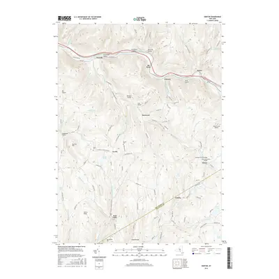
2016 Map of Horton
USGS Topo · Published 2016About this map
The Beaver Kill river corridor anchors this section of the Catskills, winding past the hamlets of Peakville, Elk Brook, Chiloway, and Horton. This waterway, historically significant for its fly-fishing heritage and timber transport, is flanked by several named islands and hollows including Halls Island, Pork Island, and Buck Hollow. The map captures a transition from the river-bottom settlements to the higher ridges and isolated valleys of the Delaware and Sullivan county line, where small crossroads like Burnwood and Goulds sit among a network of family-named roads such as Biffar Rd and Arlyn Milk Rd. Local history and genealogy are well-represented by several burial sites, including Rock Valley Cem, Horton Cem, and the remote Rickard Cem. Notable engineering landmarks appear along the eastern edge, specifically the Campbell Covered Bridge and Lower Shavertown Bridge, which cross the waters of Ash Clove Brook and Trout Brook.
Find a feature on this map
102 named features on this map. Tap any name to fly to it.
Don’t see what you’re looking for? This feature index may not catch every label — zoom into the map to look around manually.
Map Details
Editions of this 2016 Horton Map
This is the sole edition of this map. No revisions or reprints were ever made.
Other maps of this area

1920 · Long Eddy
USGS Topo · 1:62,500

1921 · Long Eddy
USGS Topo · 1:48,000

1921 · Livingston Manor
USGS Topo · 1:62,500

1922 · Andes
USGS Topo · 1:62,500

1923 · Long Eddy
USGS Topo · 1:62,500

1923 · Walton
USGS Topo · 1:48,000

1923 · Livingston Manor
USGS Topo · 1:62,500

1924 · Andes
USGS Topo · 1:62,500

1925 · Walton
USGS Topo · 1:62,500

1943 · Honesdale
USGS Topo · 1:125,000