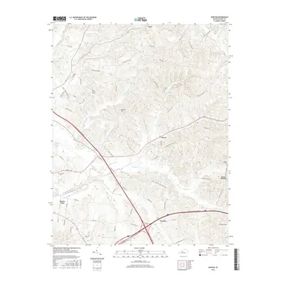
2016 Map of Horton
USGS Topo · Published 2016About this map
Beaver Dam and the surrounding drainage of the Rough River define this portion of Ohio County, Kentucky. The landscape is deeply etched by a complex network of waterways, including Muddy Cr, Pigeon Cr, and the Threelick Fork, which flow through the dissected terrain between Barnes Hill and Hickory Knob. This modern survey illustrates the intersection of mid-twentieth-century infrastructure and traditional rural settlements. The William H Natcher Pkwy and Western Kentucky Pkwy converge here, cutting through an area historically anchored by small communities like Horton, Jingo, and Rob Roy. Local history and genealogy are preserved in several family and community burial grounds, such as Taylor Cem, Voyles Cem, and Sunnyside Cem, while the Ohio County Airport represents more recent development on the outskirts of the larger population centers.
Find a feature on this map
70 named features on this map. Tap any name to fly to it.
Don’t see what you’re looking for? This feature index may not catch every label — zoom into the map to look around manually.
Map Details
Editions of this 2016 Horton Map
This is the sole edition of this map. No revisions or reprints were ever made.
Other maps of this area

1907 · Whitesville
USGS Topo · 1:62,500

1909 · Whitesville
USGS Topo · 1:62,500

1909 · Hartford
USGS Topo · 1:62,500

1925 · Spring Lick
USGS Topo · 1:62,500

1932 · Fordsville
USGS Topo · 1:62,500

1953 · Dundee
USGS Topo · 1:24,000

1953 · Pleasant Ridge
USGS Topo · 1:24,000

1954 · Evansville
USGS Topo · 1:250,000

1954 · Horton
USGS Topo · 1:24,000
1954 · Paradise
USGS Topo · 1:24,000