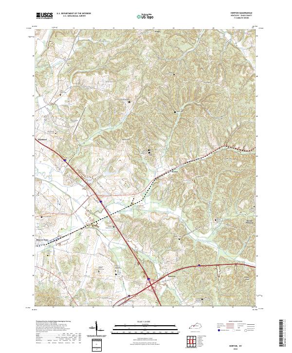
2022 Map of Horton
USGS Topo · Published 2022About this map
The Rough River and its southern tributaries define the topography of this Ohio County region, where the P & L RR corridor serves as a central artery through the settlement of Horton. The landscape is heavily marked by small community and family burial grounds, offering significant detail for genealogical research. Notable sites include the African American Bethel Cem and the Tichenor Family Farm Cem, alongside several other denominational cemeteries like Liberty Methodist Church Cem and Mount Zion Baptist Church Cem. The terrain rises from the Muddy Cr basin toward landmarks such as Barnes Hill and Hickory Knob. This area reflects a traditional Kentucky rural structure where small church-centered communities like Rob Roy and Jingo are connected by a network of named local roads and farm lanes, anchored by the proximity of Hartford and Beaver Dam.
Find a feature on this map
105 named features on this map. Tap any name to fly to it.
Don’t see what you’re looking for? This feature index may not catch every label — zoom into the map to look around manually.
Map Details
Editions of this 2022 Horton Map
This is the sole edition of this map. No revisions or reprints were ever made.
Other maps of this area

1907 · Whitesville
USGS Topo · 1:62,500

1909 · Whitesville
USGS Topo · 1:62,500

1909 · Hartford
USGS Topo · 1:62,500

1925 · Spring Lick
USGS Topo · 1:62,500

1932 · Fordsville
USGS Topo · 1:62,500

1953 · Dundee
USGS Topo · 1:24,000

1953 · Pleasant Ridge
USGS Topo · 1:24,000

1954 · Evansville
USGS Topo · 1:250,000

1954 · Horton
USGS Topo · 1:24,000
1954 · Paradise
USGS Topo · 1:24,000