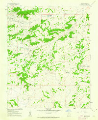
1961 Map of Hospah
USGS Topo · Published 1963About this map
Hospah Oil Field defines the industrial character of this high desert landscape, appearing here as it was surveyed in the early 1960s. The settlement of Hospah is supported by a dedicated Landing Strip and a network of unimproved roads that trace the undulating terrain of the San Juan Basin. The region’s ranching and energy-extraction roots are evident in the numerous water management features such as Sandoval Lake and a series of livestock tanks including Road Tank, Indian Tank, and Escondido Tank.
Find a feature on this map
27 named features on this map. Tap any name to fly to it.
Don’t see what you’re looking for? This feature index may not catch every label — zoom into the map to look around manually.
Map Details
Editions of this 1961 Hospah Map
2 editions found
Other maps of this area

1883 · Mt. Taylor
USGS Topo · 1:250,000

1886 · Mt. Taylor
USGS Topo · 1:250,000

1892 · Mt. Taylor
USGS Topo · 1:250,000

1899 · Mt. Taylor
USGS Topo · 1:250,000

1958 · Albuquerque
USGS Topo · 1:250,000

1961 · El Dado
USGS Topo · 1:24,000

1961 · Piedra De La Aguila
USGS Topo · 1:24,000

1961 · Whitehorse Rincon
USGS Topo · 1:24,000

1961 · Whitehorse
USGS Topo · 1:24,000

1961 · Hospah
USGS Topo · 1:24,000