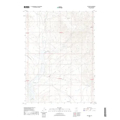
2018 Map of Hot Creek
USGS Topo · Published 2018About this map
Hot Creek Springs and the drainage network of the Snake Mountains define this high-desert landscape in Elko County. The map details a complex hydrological system where seasonal and perennial streams like Wildcat Cr and Wild Horse Cr descend into the basin, eventually feeding the broader valley of the Marys River. This area is characterized by vast open range and alluvial fans, with water sources such as Bathtub Spring serving as critical landmarks in the arid terrain.
Find a feature on this map
23 named features on this map. Tap any name to fly to it.
Don’t see what you’re looking for? This feature index may not catch every label — zoom into the map to look around manually.
Map Details
Editions of this 2018 Hot Creek Map
This is the sole edition of this map. No revisions or reprints were ever made.
Other maps of this area

1955 · Wells
USGS Topo · 1:250,000

1958 · Wells
USGS Topo · 1:250,000

1961 · Wells
USGS Topo · 1:250,000

1967 · Buena Vista Ranch
USGS Topo · 1:24,000

1967 · Black Butte NE
USGS Topo · 1:24,000

1967 · Hanks Creek NE
USGS Topo · 1:24,000

1968 · Marys River Basin NE
USGS Topo · 1:24,000

1968 · Marys River Basin SE
USGS Topo · 1:24,000

1968 · Hot Creek
USGS Topo · 1:24,000
1968 · Stormy Peak
USGS Topo · 1:24,000