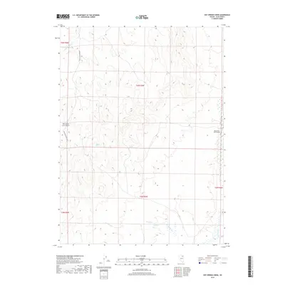
2018 Map of Hot Springs Creek
USGS Topo · Published 2018About this map
Hot Springs Cr meanders through this high-altitude corner of Elko County, feeding into the Marys River valley. The terrain is defined by dramatic hydrology, including the notable Devils Punch Bowl and the eponymous Hot Springs located in the southern portion of the quadrangle. Transport and access are primarily facilitated by the Charleston-Deeth Co Rd, which skirts the western edge of the area near Pole Canyon Creek Summit. This landscape demonstrates the essential nature of water sources in the Great Basin, marked by isolated points like Carlson Spring. Toward the east, the presence of the Marys River Ranch Airport indicates the role of private aviation in managing large ranching properties within these expansive drainage basins. The map provides a precise look at the township and range divisions, including t39n r59e, illustrating the cadastral framework of the Nevada backcountry.
Find a feature on this map
14 named features on this map. Tap any name to fly to it.
Don’t see what you’re looking for? This feature index may not catch every label — zoom into the map to look around manually.
Map Details
Editions of this 2018 Hot Springs Creek Map
This is the sole edition of this map. No revisions or reprints were ever made.
Other maps of this area

1955 · Wells
USGS Topo · 1:250,000

1958 · Wells
USGS Topo · 1:250,000

1961 · Wells
USGS Topo · 1:250,000

1967 · Hanks Creek SW
USGS Topo · 1:24,000

1967 · Black Butte SW
USGS Topo · 1:24,000

1967 · Hot Springs Creek
USGS Topo · 1:24,000

1967 · Twin Buttes
USGS Topo · 1:24,000

1967 · Stag Mountain
USGS Topo · 1:24,000

1967 · Buena Vista Ranch
USGS Topo · 1:24,000

1967 · Peko Peak
USGS Topo · 1:24,000