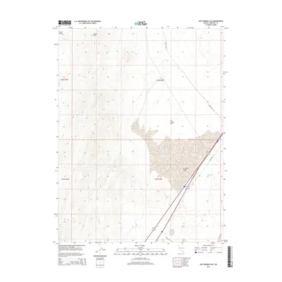
2014 Map of Hot Springs Flat
USGS Topo · Published 2014About this map
Fortymile Desert and the expansive alkali basin of Hot Springs Flat define the stark geography of this Churchill County corridor. The terrain transitions from the thermal activity at Bradys Hot Springs in the southeast to the rugged uplands of Fireball Ridge and Tolbert Canyon in the northwest. This 2014 survey documents the modern transportation network, centered on Alt 95 and remnants of Old Highway 40, illustrating how infrastructure continues to follow the paths established by early desert travelers. The presence of Sagehen Creek Rd provides a link toward the northern reaches of the quadrangle, where the basin floor meets the rising peaks. The map serves as a detailed record of the hydrographic and geological features that have long influenced movement through this notoriously arid section of Nevada.
Find a feature on this map
12 named features on this map. Tap any name to fly to it.
Don’t see what you’re looking for? This feature index may not catch every label — zoom into the map to look around manually.
Map Details
Editions of this 2014 Hot Springs Flat Map
This is the sole edition of this map. No revisions or reprints were ever made.
Other maps of this area

1890 · Wadsworth
USGS Topo · 1:125,000

1892 · Wadsworth
USGS Topo · 1:125,000

1894 · Wadsworth
USGS Topo · 1:125,000

1908 · Carson Sink
USGS Topo · 1:250,000

1910 · Carson Sink
USGS Topo · 1:250,000

1951 · Soda Lake
USGS Topo · 1:62,500

1951 · Desert Peak
USGS Topo · 1:62,500

1957 · Fireball Ridge
USGS Topo · 1:62,500

1957 · Two Tips
USGS Topo · 1:62,500

1957 · Reno
USGS Topo · 1:250,000