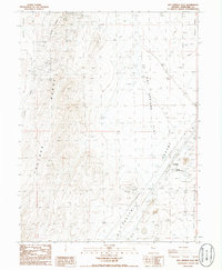
1986 Map of Hot Springs Flat
USGS Topo · Published 1986About this map
Bradys Hot Springs and the surrounding high-desert basin of Churchill County are captured here in the mid-1980s. The landscape is dominated by the vast, arid expanse of the Fortymile Desert and Hot Springs Flat, where geothermal activity is evidenced by several Geothermal Wells and a Sub Station. Evidence of early mining and transit is scattered throughout the terrain, from the many Prospects dotting the Fireball Ridge and Truckee Range to the Old RR Grade cutting through the flats. The map documents the intersection of modern infrastructure and pioneer-era pathways, featuring the Nightingale Interchange alongside the historical settlement of Jessup. This survey provides a precise record of water sources and topographical landmarks across the Alkali Flat and Tolbert Canyon during an era of significant geothermal exploration.
Find a feature on this map
21 named features on this map. Tap any name to fly to it.
Don’t see what you’re looking for? This feature index may not catch every label — zoom into the map to look around manually.
Map Details
Editions of this 1986 Hot Springs Flat Map
This is the sole edition of this map. No revisions or reprints were ever made.
Other maps of this area

1890 · Wadsworth
USGS Topo · 1:125,000

1892 · Wadsworth
USGS Topo · 1:125,000

1894 · Wadsworth
USGS Topo · 1:125,000

1908 · Carson Sink
USGS Topo · 1:250,000

1910 · Carson Sink
USGS Topo · 1:250,000

1951 · Soda Lake
USGS Topo · 1:62,500

1951 · Desert Peak
USGS Topo · 1:62,500

1957 · Fireball Ridge
USGS Topo · 1:62,500

1957 · Two Tips
USGS Topo · 1:62,500

1957 · Reno
USGS Topo · 1:250,000