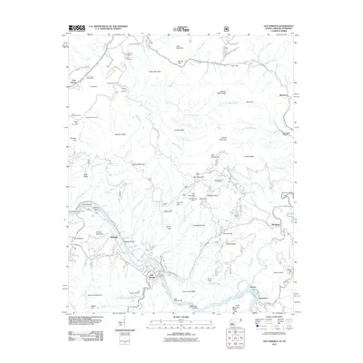
2011 Map of Hot Springs
USGS Topo · Published 2011About this map
Hot Springs serves as the focal point of this mountainous region, situated where the French Broad River carves a deep path through the Bald Mountains. The terrain is marked by numerous family-named landmarks and old cemeteries such as Lamb Cemetery and Haire Cemetery, which offer valuable data for genealogists. The influence of early 20th-century conservation and labor is visible at CCC Camp Number F 7, while the area's industrial past is anchored by Mine Hollow and the settlement of Shaleville.
Find a feature on this map
113 named features on this map. Tap any name to fly to it.
Don’t see what you’re looking for? This feature index may not catch every label — zoom into the map to look around manually.
Map Details
Editions of this 2011 Hot Springs Map
This is the sole edition of this map. No revisions or reprints were ever made.
Other maps of this area

1892 · Greeneville
USGS Topo · 1:125,000

1894 · Asheville
USGS Topo · 1:125,000

1896 · Greeneville
USGS Topo · 1:125,000

1901 · Asheville
USGS Topo · 1:125,000

1904 · Greeneville
USGS Topo · 1:125,000

1935 · Paint Rock
USGS Topo · 1:24,000

1935 · Cedar Creek
USGS Topo · 1:24,000

1935 · Hot Springs
USGS Topo · 1:24,000

1935 · Spring Creek
USGS Topo · 1:24,000

1935 · Lemon Gap
USGS Topo · 1:24,000