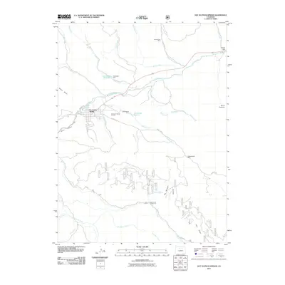
2011 Map of Hot Sulphur Springs
USGS Topo · Published 2011About this map
Hot Sulphur Springs serves as the focal point of this Rocky Mountain landscape, positioned where the Colorado River carves through the dramatic Byers Canyon. The town's grid is established south of Railroad Ave, with the Hot Sulphur Springs Cemetery located just to the east. The surrounding high country is defined by significant peaks such as Mount Bross and Mount Chauncey, while the drainage system is complex, featuring Sheriff Creek, Gardiner Creek, and the headwaters of Strawberry Creek. Human imprint on the water is evident at Huntington Reservoir and Cottonwood Reservoir. To the north, the Drowsey Water Ranch sits along Drowsy Water Creek, while the southern reaches of the quadrangle include the Beaver Creek Campground near Big Meadows, illustrating the area's transition from a settled river valley to managed forest and recreation lands.
Find a feature on this map
41 named features on this map. Tap any name to fly to it.
Don’t see what you’re looking for? This feature index may not catch every label — zoom into the map to look around manually.
Map Details
Editions of this 2011 Hot Sulphur Springs Map
This is the sole edition of this map. No revisions or reprints were ever made.
Other maps of this area

1915 · Longs Peak
USGS Topo · 1:125,000

1919 · Rocky Mountain National Park
USGS Topo · 1:125,000

1924 · Fraser
USGS Topo · 1:62,500

1926 · Fraser
USGS Topo · 1:62,500

1933 · Ute Peak
USGS Topo · 1:62,500

1937 · Ute Peak
USGS Topo · 1:62,500

1953 · Denver
USGS Topo · 1:250,000

1954 · Greeley
USGS Topo · 1:250,000

1954 · Craig
USGS Topo · 1:250,000

1957 · Denver
USGS Topo · 1:250,000