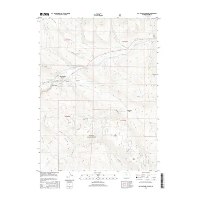
2016 Map of Hot Sulphur Springs
USGS Topo · Published 2016About this map
The town of Hot Sulphur Springs serves as the focal point of this survey, situated at a strategic bend where the Colorado River enters the narrow corridor of Byers Canyon. The town's grid, including Grand St and Byers Ave, sits just west of the Hot Sulphur Springs Cem, illustrating the community's established footprint in the Middle Park basin. To the north and south, the landscape is defined by irrigation and water management features like Dennis Ditch, the Jones High-Line Ditch, and Huntington Reservoir, which support the high-altitude ranching and agricultural lands of Big Meadows. Significant elevation changes are marked by Mt Bross and Mt Chauncey, while the southern portion of the sheet transition into the protected lands of the Arapaho National Forest. This network of ditches and reservoirs highlights the vital role of water rights and engineering in sustaining this mountain settlement.
Find a feature on this map
58 named features on this map. Tap any name to fly to it.
Don’t see what you’re looking for? This feature index may not catch every label — zoom into the map to look around manually.
Map Details
Editions of this 2016 Hot Sulphur Springs Map
This is the sole edition of this map. No revisions or reprints were ever made.
Other maps of this area

1915 · Longs Peak
USGS Topo · 1:125,000

1919 · Rocky Mountain National Park
USGS Topo · 1:125,000

1924 · Fraser
USGS Topo · 1:62,500

1926 · Fraser
USGS Topo · 1:62,500

1933 · Ute Peak
USGS Topo · 1:62,500

1937 · Ute Peak
USGS Topo · 1:62,500

1953 · Denver
USGS Topo · 1:250,000

1954 · Greeley
USGS Topo · 1:250,000

1954 · Craig
USGS Topo · 1:250,000

1957 · Denver
USGS Topo · 1:250,000