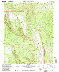
2001 Map of Hotel Rock
USGS Topo · Published 2004About this map
Milk Ranch Point dominates the high ground of the Manti-La Sal National Forest in this survey revised by the Forest Service at the turn of the 21st century. The landscape is defined by the dramatic north-south alignment of Comb Ridge, which separates the drainage of Comb Wash from the curiously named Cheese and Raisins terrain to the east. Human presence is concentrated near water sources and travel corridors, evidenced by the Perkins Ranch and the eponymous Hotel Rock landmark. To the west, the intricate topography of Little Baullies and the deep incisions of Arch Canyon and Mule Canyon illustrate the complex drainage systems characteristic of the San Juan region. The map also records early industrial efforts through numerous Drill Holes and a Prospect located near the eastern edge of the quadrangle.
Find a feature on this map
48 named features on this map. Tap any name to fly to it.
Don’t see what you’re looking for? This feature index may not catch every label — zoom into the map to look around manually.
Map Details
Editions of this 2001 Hotel Rock Map
This is the sole edition of this map. No revisions or reprints were ever made.
Other maps of this area

1886 · Abajo
USGS Topo · 1:250,000

1892 · Abajo
USGS Topo · 1:250,000

1893 · Abajo
USGS Topo · 1:250,000

1935 · Elk Ridge
USGS Topo · 1:96,000

1940 · Elk Ridge
USGS Topo · 1:125,000

1954 · Elk Ridge 4 NW
USGS Topo · 1:24,000

1954 · Elk Ridge 3 NE
USGS Topo · 1:24,000

1954 · Elk Ridge 3 SE
USGS Topo · 1:24,000

1954 · Bears Ears
USGS Topo · 1:62,500

1956 · Cortez
USGS Topo · 1:250,000