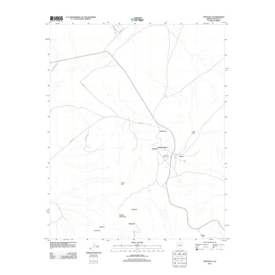
2011 Map of Hotevilla
USGS Topo · Published 2011About this map
Hotevilla and Bacavi occupy the elevated landscape of Third Mesa in this contemporary 2011 survey, reflecting the enduring settlement patterns of the Hopi Reservation. The map documents a cluster of traditional and modern sites, anchored by the Hotevilla Post Office and the critical water source at Hotevilla Spring. The distribution of place names like Mahtson-pi, Huk Ovi, and Pivahn-hon-kya-pi throughout the terrain suggests a deeply rooted geography where cultural and historical landmarks are inextricably tied to the mesa's edge.
Find a feature on this map
22 named features on this map. Tap any name to fly to it.
Don’t see what you’re looking for? This feature index may not catch every label — zoom into the map to look around manually.
Map Details
Editions of this 2011 Hotevilla Map
This is the sole edition of this map. No revisions or reprints were ever made.
Other maps of this area

1883 · Marsh Pass
USGS Topo · 1:250,000

1883 · Tusayan
USGS Topo · 1:250,000

1886 · Tusayan
USGS Topo · 1:250,000

1892 · Marsh Pass
USGS Topo · 1:250,000

1947 · Flagstaff
USGS Topo · 1:250,000

1954 · Flagstaff
USGS Topo · 1:250,000

1956 · Marble Canyon
USGS Topo · 1:250,000

1958 · Flagstaff
USGS Topo · 1:250,000

1959 · Marble Canyon
USGS Topo · 1:250,000

1960 · Flagstaff
USGS Topo · 1:250,000