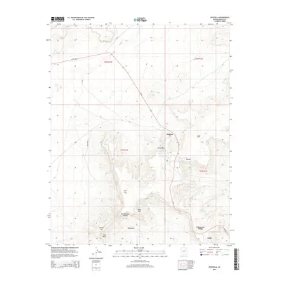
2014 Map of Hotevilla
USGS Topo · Published 2014About this map
Third Mesa and Oraibi Mesa define the high-desert geography of this region in Navajo County, where ancient patterns of settlement remain visible in the high-altitude landscape. The modern communities of Hotevilla, Bacavi, and Kykotsmovi Village are situated along the critical transit corridor of Az-264, which winds through the sandstone formations. The map documents numerous traditional sites including Pivahn-hon-kya-pi, Huk Ovi, and Mumurva, alongside the historic settlement of Oraibi. Water sources, though scarce, are recorded at locations like Hotevilla Spring and the ephemeral drainages of Siwukva and Howimpa. Smaller routes like Bear Spring Rd and Bia-9 provide access between the mesas, while Oraibi Butte stands as a prominent landmark in the southwestern portion of the quadrangle. The survey illustrates the concentration of cultural and residential life on the mesa tops, a strategy shaped by the local topography and resource availability.
Find a feature on this map
24 named features on this map. Tap any name to fly to it.
Don’t see what you’re looking for? This feature index may not catch every label — zoom into the map to look around manually.
Map Details
Editions of this 2014 Hotevilla Map
This is the sole edition of this map. No revisions or reprints were ever made.
Other maps of this area

1883 · Marsh Pass
USGS Topo · 1:250,000

1883 · Tusayan
USGS Topo · 1:250,000

1886 · Tusayan
USGS Topo · 1:250,000

1892 · Marsh Pass
USGS Topo · 1:250,000

1947 · Flagstaff
USGS Topo · 1:250,000

1954 · Flagstaff
USGS Topo · 1:250,000

1956 · Marble Canyon
USGS Topo · 1:250,000

1958 · Flagstaff
USGS Topo · 1:250,000

1959 · Marble Canyon
USGS Topo · 1:250,000

1960 · Flagstaff
USGS Topo · 1:250,000