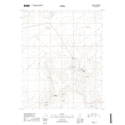
2018 Map of Hotevilla
USGS Topo · Published 2018About this map
Third Mesa and Oraibi Mesa dominate this high desert landscape, providing the dramatic elevation that has long defined the settlement patterns of Navajo County. The high-ground villages of Hotevilla, Bacavi, and Oraibi are concentrated along the rims and slopes of these landforms, connected by a network of contemporary roads including Indian Rte 9 and Indian Rte 13. The mapping reflects the vital importance of water sources in this arid environment, specifically noted at Hotevilla Spring and other drainage features like Mumurva and Siwivkva. Cultural and geographic landmarks such as Huk Ovi, Aponi-vi, and Pivahn-hon-kya-pi appear across the mesa tops, while the lower elevations near Oraibi Butte illustrate the transition into the surrounding valley floor. This 2018 survey serves as a detailed record of these ancient and enduring communities at the start of the 21st century.
Find a feature on this map
25 named features on this map. Tap any name to fly to it.
Don’t see what you’re looking for? This feature index may not catch every label — zoom into the map to look around manually.
Map Details
Editions of this 2018 Hotevilla Map
This is the sole edition of this map. No revisions or reprints were ever made.
Other maps of this area

1883 · Marsh Pass
USGS Topo · 1:250,000

1883 · Tusayan
USGS Topo · 1:250,000

1886 · Tusayan
USGS Topo · 1:250,000

1892 · Marsh Pass
USGS Topo · 1:250,000

1947 · Flagstaff
USGS Topo · 1:250,000

1954 · Flagstaff
USGS Topo · 1:250,000

1956 · Marble Canyon
USGS Topo · 1:250,000

1958 · Flagstaff
USGS Topo · 1:250,000

1959 · Marble Canyon
USGS Topo · 1:250,000

1960 · Flagstaff
USGS Topo · 1:250,000