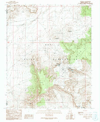
1991 Map of Hotevilla
USGS Topo · Published 1991About this map
The villages of Hotevilla and Bacavi anchor this high-desert landscape on the Hopi Indian Reservation, where cultural history is etched into the topography. Situated atop the prominent Third Mesa, these settlements overlook a terrain defined by deep-cut washes and sacred springs, most notably Hotevilla Spring. The proximity of the ancient village of Oraibi and the Tug-of-War Historical Marker indicates a region with deep temporal roots, where traditional Hopi life continues alongside infrastructure like the Siwukva Corral and various water tanks. The land drops away toward the Dinnebito Wash to the northwest, revealing a complex network of canyons and bluffs such as Oraibi Butte and Hoonawpa. This mapping shows the intersection of modern reservation life with enduring landmarks, from the Sewage Disposal Ponds to the high points of Yantukyaovi Northeast.
Find a feature on this map
27 named features on this map. Tap any name to fly to it.
Don’t see what you’re looking for? This feature index may not catch every label — zoom into the map to look around manually.
Map Details
Editions of this 1991 Hotevilla Map
This is the sole edition of this map. No revisions or reprints were ever made.
Other maps of this area

1883 · Marsh Pass
USGS Topo · 1:250,000

1883 · Tusayan
USGS Topo · 1:250,000

1886 · Tusayan
USGS Topo · 1:250,000

1892 · Marsh Pass
USGS Topo · 1:250,000

1947 · Flagstaff
USGS Topo · 1:250,000

1954 · Flagstaff
USGS Topo · 1:250,000

1956 · Marble Canyon
USGS Topo · 1:250,000

1958 · Flagstaff
USGS Topo · 1:250,000

1959 · Marble Canyon
USGS Topo · 1:250,000

1960 · Flagstaff
USGS Topo · 1:250,000