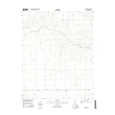
2016 Map of Hough SW
USGS Topo · Published 2016About this map
Goff Creek meanders through the northern section of this High Plains landscape, a vital watercourse in the arid panhandle environment. The 2016 survey captures the rural character of Texas County, defined by a rigid grid of section roads and small, dispersed community hubs like Hovey and Unity. Local history is anchored at the Bethel Cem in the southeast, while the southern portion of the sheet is bisected by a prominent roadway corridor connecting local ranching and agricultural operations. The drainage patterns of Little Goff Cr and Cow Cr provide the primary relief to the otherwise level topography, illustrating how water access shaped the settlement and road network of this Oklahoman territory.
Find a feature on this map
39 named features on this map. Tap any name to fly to it.
Don’t see what you’re looking for? This feature index may not catch every label — zoom into the map to look around manually.
Map Details
Editions of this 2016 Hough SW Map
This is the sole edition of this map. No revisions or reprints were ever made.
Other maps of this area

1954 · Perryton
USGS Topo · 1:250,000

1958 · Perryton
USGS Topo · 1:250,000

1973 · Texhoma NE
USGS Topo · 1:24,000

1973 · Goodwell NW
USGS Topo · 1:24,000

1973 · Eva SE
USGS Topo · 1:24,000

1973 · Hough SW
USGS Topo · 1:24,000

1973 · Hough NE
USGS Topo · 1:24,000

1973 · Goodwell NE
USGS Topo · 1:24,000

1973 · Hough NW
USGS Topo · 1:24,000
1973 · Eva NE
USGS Topo · 1:24,000