
1973 Map of Hough SW
USGS Topo · Published 1975About this map
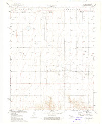
Carthage Oil and Gas Field defines the industrial character of this Oklahoma Panhandle landscape, where an extensive network of Gas Wells and infrastructure like the Compressor Station dominate the terrain. The map captures the region in the early 1970s, revealing a landscape defined by resource extraction and sparse rural settlement. Small locales like Hovey in the north and Unity in the south serve as local landmarks alongside family-oriented sites such as Bethel Cem. Drainage is provided by the winding path of Goff Creek and its tributary, Little Goff Creek, which cut through the high plains. The distribution of Caliche Pits and various wells across sections like Turney illustrates the systematic development of the area's subterranean resources during this era of domestic energy production.
Find a feature on this map
15 named features on this map. Tap any name to fly to it.
Don’t see what you’re looking for? This feature index may not catch every label — zoom into the map to look around manually.
Map Details
Editions of this 1973 Hough SW Map
This is the sole edition of this map. No revisions or reprints were ever made.
Other maps of this area

1954 · Perryton
USGS Topo · 1:250,000

1958 · Perryton
USGS Topo · 1:250,000

1973 · Texhoma NE
USGS Topo · 1:24,000

1973 · Goodwell NW
USGS Topo · 1:24,000

1973 · Eva SE
USGS Topo · 1:24,000

1973 · Hough NE
USGS Topo · 1:24,000

1973 · Goodwell NE
USGS Topo · 1:24,000

1973 · Hough NW
USGS Topo · 1:24,000
1973 · Eva NE
USGS Topo · 1:24,000
1973 · Hough
USGS Topo · 1:24,000