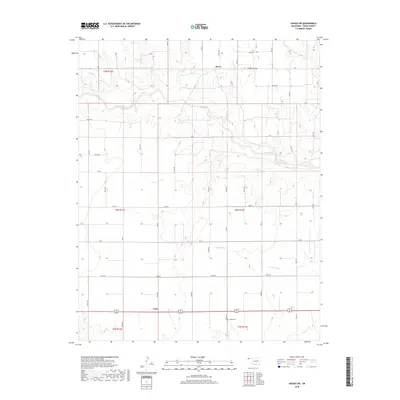
2018 Map of Hough SW
USGS Topo · Published 2018About this map
Hovey and Unity anchor this section of the Oklahoma Panhandle, where the high plains are dissected by the drainage systems of Goff Creek and Little Goff Cr. The landscape is defined by the rigid grid of the Public Land Survey System, with township boundaries such as t4n r13e and t5n r12e organizing the territory into expansive agricultural sections. At the southern edge of the map, Bethel Cem provides a specific point of genealogical interest, situated near the intersection of modern transit routes and historical land divisions. The intermittent nature of watercourses like Cow Cr reflects the arid character of Texas County, where life and settlement patterns have long been dictated by the sparse availability of surface water and the reliable geometry of the section line roads.
Find a feature on this map
18 named features on this map. Tap any name to fly to it.
Don’t see what you’re looking for? This feature index may not catch every label — zoom into the map to look around manually.
Map Details
Editions of this 2018 Hough SW Map
This is the sole edition of this map. No revisions or reprints were ever made.
Other maps of this area

1954 · Perryton
USGS Topo · 1:250,000

1958 · Perryton
USGS Topo · 1:250,000

1973 · Texhoma NE
USGS Topo · 1:24,000

1973 · Goodwell NW
USGS Topo · 1:24,000

1973 · Eva SE
USGS Topo · 1:24,000

1973 · Hough SW
USGS Topo · 1:24,000

1973 · Hough NE
USGS Topo · 1:24,000

1973 · Goodwell NE
USGS Topo · 1:24,000

1973 · Hough NW
USGS Topo · 1:24,000
1973 · Eva NE
USGS Topo · 1:24,000