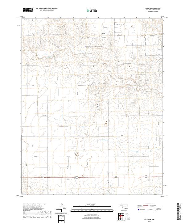
2022 Map of Hough SW
USGS Topo · Published 2022About this map
Goff Creek meanders through the heart of this Texas County landscape, carving through a region defined by its rigid section-line road grid and rural homesteads. The terrain transitions between the creek bottoms and the higher plains of the Oklahoma Panhandle, where the small community of Hovey sits in the northern reaches and Unity occupies the south along a primary east-west route. This area represents the quintessential agricultural layout of the High Plains, where vast stretches of land are organized around systematic local roads like n0745 RD and e0160 RD.
Find a feature on this map
44 named features on this map. Tap any name to fly to it.
Don’t see what you’re looking for? This feature index may not catch every label — zoom into the map to look around manually.
Map Details
Editions of this 2022 Hough SW Map
This is the sole edition of this map. No revisions or reprints were ever made.
Other maps of this area

1954 · Perryton
USGS Topo · 1:250,000

1958 · Perryton
USGS Topo · 1:250,000

1973 · Texhoma NE
USGS Topo · 1:24,000

1973 · Goodwell NW
USGS Topo · 1:24,000

1973 · Eva SE
USGS Topo · 1:24,000

1973 · Hough SW
USGS Topo · 1:24,000

1973 · Hough NE
USGS Topo · 1:24,000

1973 · Goodwell NE
USGS Topo · 1:24,000

1973 · Hough NW
USGS Topo · 1:24,000
1973 · Eva NE
USGS Topo · 1:24,000