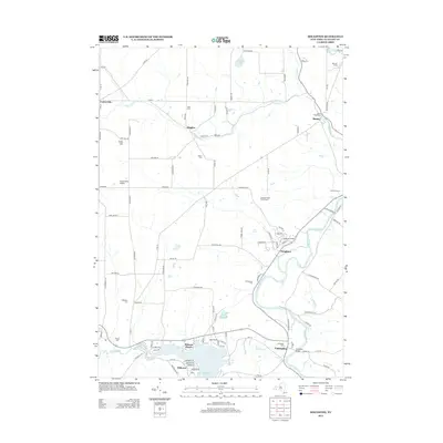
2013 Map of Houghton
USGS Topo · Published 2013About this map
The Genesee River winds through this Allegany County landscape, anchoring the campus of Houghton College and the surrounding community of Houghton. This 2013 survey highlights the transition from the river valley to the elevated terrain of Swift Hill, revealing a mix of agricultural heritage and modern recreational development. To the south, the northern reaches of Rushford Lake create a distinct shoreline at Balcom Beach and Hillcrest. Local history is preserved in numerous family and community burial grounds, including the Bates Cem and Podonque Cem. The infrastructure of the era is marked by landmarks such as the Caneadea Bridge and the small Plane Haven Airport, while the legacy of land use is visible at Speicher Farms and Hoffman Farms near Hume.
Find a feature on this map
105 named features on this map. Tap any name to fly to it.
Don’t see what you’re looking for? This feature index may not catch every label — zoom into the map to look around manually.
Map Details
Editions of this 2013 Houghton Map
This is the sole edition of this map. No revisions or reprints were ever made.
Other maps of this area

1905 · Portage
USGS Topo · 1:62,500

1906 · Angelica
USGS Topo · 1:62,500

1923 · Arcade
USGS Topo · 1:62,500

1924 · Franklinville
USGS Topo · 1:62,500

1925 · Arcade
USGS Topo · 1:62,500

1941 · Angelica
USGS Topo · 1:62,500

1942 · Franklinville
USGS Topo · 1:62,500

1943 · Portageville
USGS Topo · 1:24,000

1943 · Pike
USGS Topo · 1:24,000

1944 · Pike
USGS Topo · 1:31,680