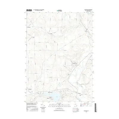
2016 Map of Houghton
USGS Topo · Published 2016About this map
Rushford Lake and the winding Genesee River anchor the landscape of northern Allegany County, where agricultural valleys meet the academic community surrounding Houghton Coll. The settlement of Houghton serves as a central hub, while the surrounding hillsides are dotted with legacy family settlements and burial grounds such as Hume Village Cem and Mount Pleasant Cem. The southern reach of the map features the recreation-oriented communities of Balcom Beach and Hillcrest along the northern shore of the lake. Northward, the landscape shifts toward the smaller hamlets of Higgins and Centerville, connected by a network of drainage creeks including Sixtown Cr and Wiscoy Creek. Local infrastructure like the Caneadea Bridge near the village of Caneadea illustrates the historical importance of river crossings in this corner of New York, providing a clear view of the area's development and topography.
Find a feature on this map
95 named features on this map. Tap any name to fly to it.
Don’t see what you’re looking for? This feature index may not catch every label — zoom into the map to look around manually.
Map Details
Editions of this 2016 Houghton Map
This is the sole edition of this map. No revisions or reprints were ever made.
Other maps of this area

1905 · Portage
USGS Topo · 1:62,500

1906 · Angelica
USGS Topo · 1:62,500

1923 · Arcade
USGS Topo · 1:62,500

1924 · Franklinville
USGS Topo · 1:62,500

1925 · Arcade
USGS Topo · 1:62,500

1941 · Angelica
USGS Topo · 1:62,500

1942 · Franklinville
USGS Topo · 1:62,500

1943 · Portageville
USGS Topo · 1:24,000

1943 · Pike
USGS Topo · 1:24,000

1944 · Pike
USGS Topo · 1:31,680