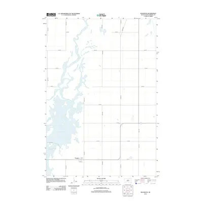
2012 Map of Houghton
USGS Topo · Published 2012About this map
Houghton sits at the intersection of a sprawling water system in Brown County, where the meandering path of the James River feeds into significant catchment areas. The landscape is dominated by the Mud Lake Reservoir and the Columbia Road Reservoir, which together shape the local geography and suggest a region deeply tied to water management and drainage. This 2012 survey illustrates the grid-based settlement pattern of the northern plains, where numbered avenues like 399th Ave and 400th Ave define the agricultural sections.
Find a feature on this map
21 named features on this map. Tap any name to fly to it.
Don’t see what you’re looking for? This feature index may not catch every label — zoom into the map to look around manually.
Map Details
Editions of this 2012 Houghton Map
This is the sole edition of this map. No revisions or reprints were ever made.
Other maps of this area

1894 · Hecla
USGS Topo · 1:62,500

1894 · Columbia
USGS Topo · 1:62,500

1894 · Savo
USGS Topo · 1:62,500

1896 · Columbia
USGS Topo · 1:125,000

1952 · Columbia NE
USGS Topo · 1:24,000

1953 · Hecla SE
USGS Topo · 1:24,000

1953 · Houghton
USGS Topo · 1:24,000
1953 · Savo SE
USGS Topo · 1:24,000

1954 · Daly Corners
USGS Topo · 1:24,000

1954 · Aberdeen
USGS Topo · 1:250,000
Featured Places
- Hecla Township, SD
- Greenfield Township, SD
- Shelby Township, SD
- Lansing Township, SD
- Liberty Township, SD