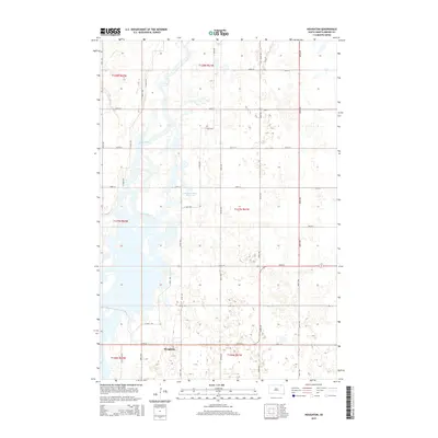
2015 Map of Houghton
USGS Topo · Published 2015About this map
Houghton sits at the heart of this agricultural landscape in northern Brown County, situated just west of a significant bend in the James River. The terrain is characterized by the river's meandering path and the Columbia Road Reservoir, which together create a complex network of wetlands and seasonal water bodies typical of this prairie region. This 2015 survey illustrates a highly structured section-line road system, including 399th Ave and 404th Ave, that segments the land into traditional square-mile grids for large-scale farming. A notable path, the N Tour Rte, winds through the central portion of the map, suggesting localized access through the river bottoms and reservoir area. This map is an essential record of the contemporary rural infrastructure and hydrological patterns of the northern James River Valley.
Find a feature on this map
24 named features on this map. Tap any name to fly to it.
Don’t see what you’re looking for? This feature index may not catch every label — zoom into the map to look around manually.
Map Details
Editions of this 2015 Houghton Map
This is the sole edition of this map. No revisions or reprints were ever made.
Other maps of this area

1894 · Hecla
USGS Topo · 1:62,500

1894 · Columbia
USGS Topo · 1:62,500

1894 · Savo
USGS Topo · 1:62,500

1896 · Columbia
USGS Topo · 1:125,000

1952 · Columbia NE
USGS Topo · 1:24,000

1953 · Hecla SE
USGS Topo · 1:24,000

1953 · Houghton
USGS Topo · 1:24,000
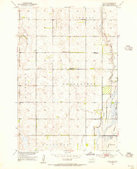
1953 · Savo SE
USGS Topo · 1:24,000

1954 · Daly Corners
USGS Topo · 1:24,000

1954 · Aberdeen
USGS Topo · 1:250,000
Featured Places
- Hecla Township, SD
- Greenfield Township, SD
- Shelby Township, SD
- Lansing Township, SD
- Liberty Township, SD