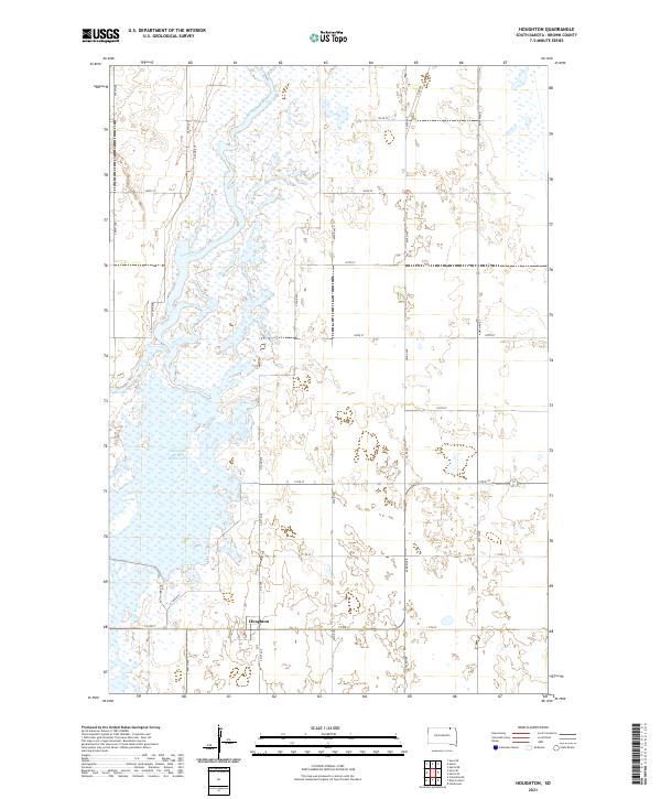
2021 Map of Houghton
USGS Topo · Published 2021About this map
Houghton occupies a central position in this survey of Brown County, situated along the northern stretch of the James River. The landscape is defined by the river's meandering path and the extensive Columbia Road Reservoir, which dominates the western half of the quadrangle. The intersection of local infrastructure and historical transit is evident in the presence of Railway St, signaling the rail-dependent economy that shaped this prairie settlement. The map provides a detailed view of the rural grid system, with roads such as 400th Ave and Co Rd 7 framing the surrounding farmland. Modern land use is further indicated by the Auto-Tour Rte and N Tour Rte, suggesting the area's contemporary role as a managed natural environment or wildlife observation corridor within the river basin.
Find a feature on this map
28 named features on this map. Tap any name to fly to it.
Don’t see what you’re looking for? This feature index may not catch every label — zoom into the map to look around manually.
Map Details
Editions of this 2021 Houghton Map
This is the sole edition of this map. No revisions or reprints were ever made.
Other maps of this area

1894 · Hecla
USGS Topo · 1:62,500

1894 · Columbia
USGS Topo · 1:62,500

1894 · Savo
USGS Topo · 1:62,500

1896 · Columbia
USGS Topo · 1:125,000

1952 · Columbia NE
USGS Topo · 1:24,000

1953 · Hecla SE
USGS Topo · 1:24,000

1953 · Houghton
USGS Topo · 1:24,000
1953 · Savo SE
USGS Topo · 1:24,000

1954 · Daly Corners
USGS Topo · 1:24,000

1954 · Aberdeen
USGS Topo · 1:250,000