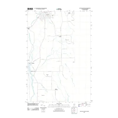
2011 Map of Houlton South
USGS Topo · Published 2011About this map
Jackins Settlement and Union Corners anchor the southern agricultural reaches of this 2011 survey along the Canadian border. The landscape is defined by the winding course of the Meduxnekeag River and its major tributary, the South Branch Meduxnekeag River, which flows past the Hodgdon Dam. While the northern edge captures the municipal core of Houlton, including the Houlton Post Office and the elevation of Reservoir Hill, the rest of the map reveals a rural network of family-named roads and hills.
Find a feature on this map
48 named features on this map. Tap any name to fly to it.
Don’t see what you’re looking for? This feature index may not catch every label — zoom into the map to look around manually.
Map Details
Editions of this 2011 Houlton South Map
This is the sole edition of this map. No revisions or reprints were ever made.
Other maps of this area

1938 · Houlton
USGS Topo · 1:62,500

1940 · Amity
USGS Topo · 1:62,500

1941 · Amity
USGS Topo · 1:62,500

1943 · Amity
USGS Topo · 1:62,500

1951 · Houlton
USGS Topo · 1:62,500

1957 · Fredericton
USGS Topo · 1:250,000
1958 · Amity
USGS Topo · 1:62,500

1959 · Woodstock
USGS Topo · 1:250,000

1963 · Woodstock
USGS Topo · 1:250,000

1963 · Fredericton
USGS Topo · 1:250,000