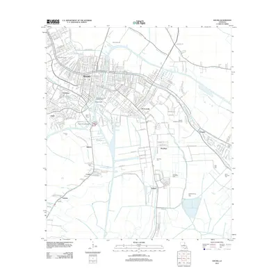
2012 Map of Houma
USGS Topo · Published 2012About this map
Houma serves as the focal point of this coastal Louisiana landscape, where the intricate network of bayous and canals dictates the pattern of settlement and industry. The town is physically tied to its maritime environment through engineering landmarks like the Houma Tunnel and the Houma Navigation Bridge, while the Charlie Hammonds Seaplane Base underscores the importance of aerial access in this water-bound region. Surrounding communities such as Mechanicville, Mulberry, and Crozier are defined by their proximity to waterways like Bayou Terrebonne and Bayou La Carpe, which have historically driven the local economy.
Find a feature on this map
260 named features on this map. Tap any name to fly to it.
Don’t see what you’re looking for? This feature index may not catch every label — zoom into the map to look around manually.
Map Details
Editions of this 2012 Houma Map
This is the sole edition of this map. No revisions or reprints were ever made.
Other maps of this area

1892 · Gibson
USGS Topo · 1:62,500

1892 · Houma
USGS Topo · 1:62,500

1894 · Bayou De Large
USGS Topo · 1:62,500

1894 · Dulac
USGS Topo · 1:62,500

1897 · Gibson
USGS Topo · 1:62,500

1932 · Houma SE
USGS Topo · 1:31,680

1932 · Houma SW
USGS Topo · 1:31,680

1932 · Houma NE
USGS Topo · 1:31,680

1932 · Houma NW
USGS Topo · 1:31,680

1935 · Theriot
USGS Topo · 1:31,680